
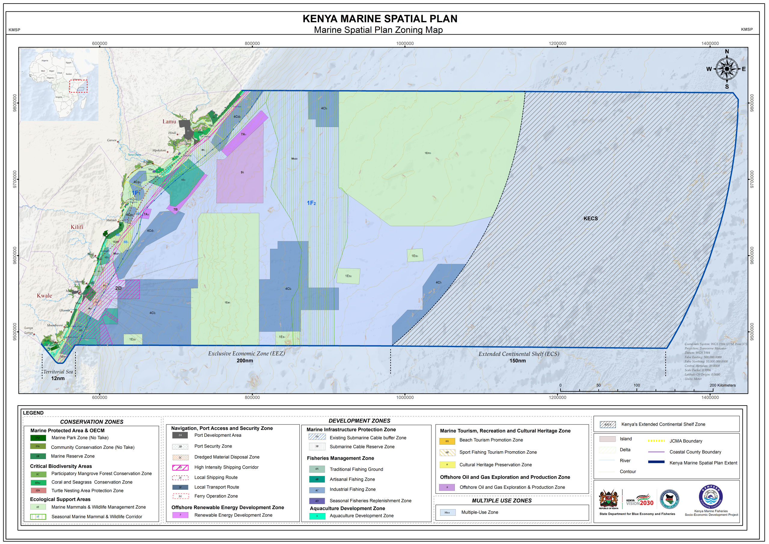
The Kenya Marine Spatial Plan (MSP) 2025–2045 was prepared as a strategic, integrated, and spatially explicit framework to guide the sustainable use, development, and conservation of Kenya’s marine and coastal resources. Domiciled across national and county governance frameworks, the plan responds to growing competition for marine space from sectors like fisheries, tourism, maritime transport, port expansion, renewable energy, and the emerging Blue Economy. Key deliverables for the assignment include a comprehensive 20-year zoning layout spanning from the shoreline High Water Mark to the outer limits of the Exclusive Economic Zone (EEZ), alongside a robust regulatory matrix for long-term ocean governance.
2023
Kenya
2026
258,921.317km2
State Department For Blue Economy & Fisheries
0712151779
office@geodev.co.ke
View the project
View the project
View the project
View the project
