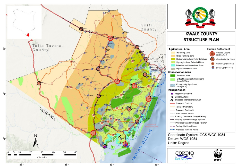
Kwale county spatial plan is a ten (10) year GIS based plan that provides the framework for optimal use of available resources through organization, coordination and distribution of land uses, people and their activities to enhance service delivery through infrastructure provision for socio-economic development, environmental conservation and management, enhance lower level planning and proper governance. This plan’s objectives are to designate land use zones with specific land-use guidelines, integrate sectoral, local, regional and national policies and strategies into the land use plan, provide a framework to anchor lower-level plans, guide the use and management of natural resources, identify economic investment areas, revitalize the county through rural urban linkages guide to environmental protection and conservation, improve transport and communication network and linkages and develop sustainable urban system.
The undertaking of this project benefited the county by providing the framework for enhancing agricultural productivity, developing sustainable human settlements and urban development, promoting investment and optimizing the potential of marine resources and the blue economy. The principles/concepts adopted in the development of the plan are; citizen participation building partnerships and collaboration, transparency and inclusivity, multi-sectoral and multi-disciplinary engagement and strategic and integrated approach in decision making.
2018
Kenya - Kwale County
2020
8270.2km2
2018
Kwale County
2020
8270.2 km
Kwale County Government
0712151779
office@geodev.co.ke
View the project
View the project