Consultancy Services for provision of the support on the development of Kenya Marine spatial planning(MSP) at kEMFSED Project

Project in brief

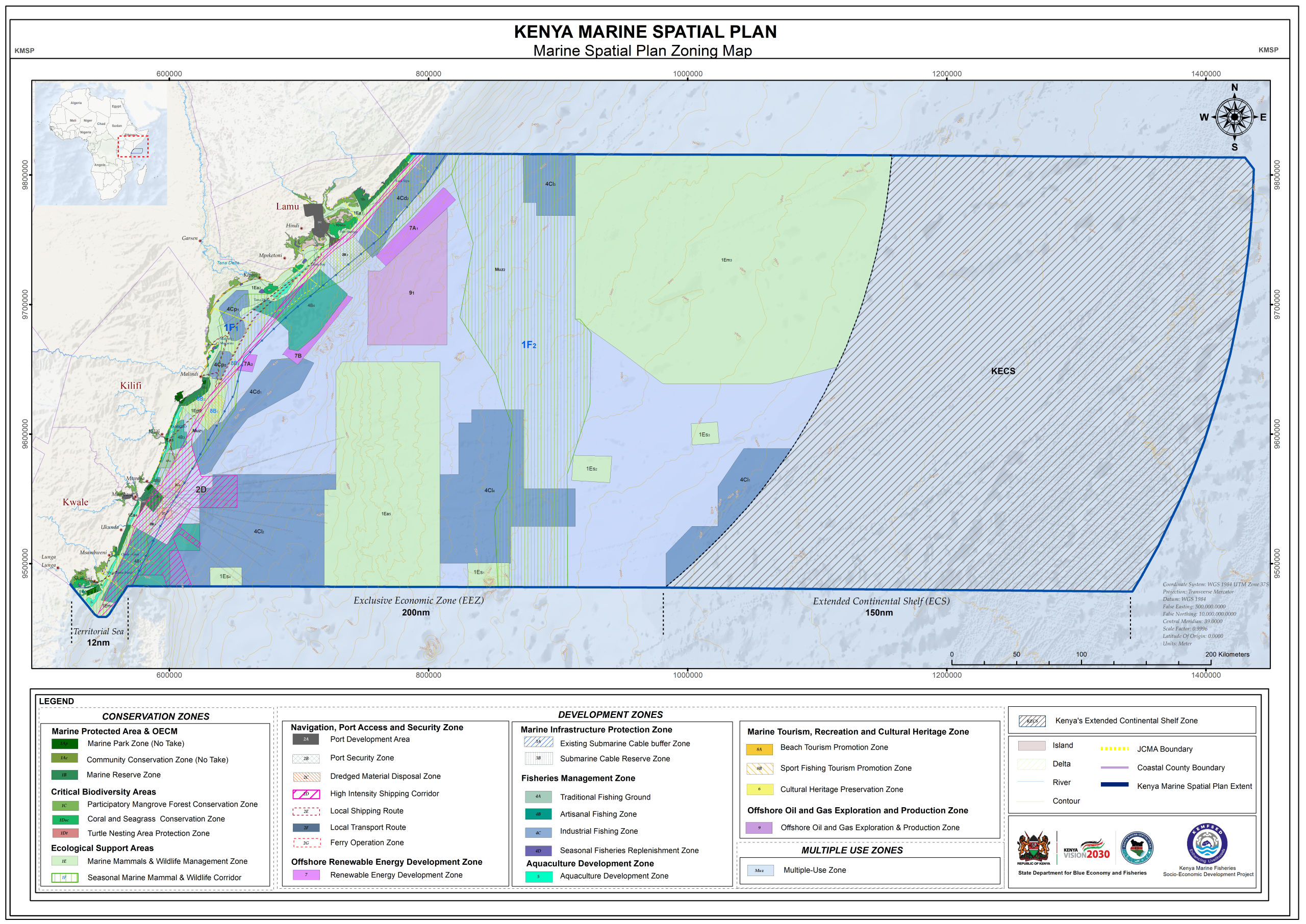
The Kenya Marine Spatial Plan (MSP) 2025–2045 was prepared as a strategic, integrated, and spatially explicit framework to guide the sustainable use, development, and conservation of Kenya’s marine and coastal resources. Domiciled across national and county governance frameworks, the plan responds to growing competition for marine space from sectors like fisheries, tourism, maritime transport, port expansion, renewable energy, and the emerging Blue Economy. Key deliverables for the assignment include a comprehensive 20-year zoning layout spanning from the shoreline High Water Mark to the outer limits of the Exclusive Economic Zone (EEZ), alongside a robust regulatory matrix for long-term ocean governance.

The strategy aims to develop a pathway that shifts marine management from fragmented, sector-based decision-making to coordinated spatial governance. By reducing spatial conflicts and enhancing regulatory clarity, the plan strengthens investment certainty for sustainable economic growth while actively safeguarding critical ecosystems. The resulting frameworks review the capacities of five adjacent coastal counties Kwale, Mombasa, Kilifi, Tana River, and Lamu to manage nearshore congestion, address cumulative environmental pressures, and identify vital cross-sector initiatives that balance economic development with ecological resilience.
The plan was developed for a 20-year planning horizon (2025–2045), driven by extensive baseline spatial analysis, ecosystem value screening, and multi-stakeholder suitability assessments. The diagnostic process targeted high-intensity conflict zones, evaluating the interdependence between nearshore human activities and vulnerable offshore habitats like coral reefs, mangroves, and seagrass meadows. The development of the zoning strategy establishes distinct Conservation, Sustainable Use, and Economic Development Zones, supported by clear operational matrices to ensure transparent, enforceable, and adaptive management over time.

Project Details

Start Date

2023

Location:

Kenya

End Date

2026

Area SIze

258,921.317km2

Client

State Department For Blue Economy & Fisheries

Contact Us

Call us today

0712151779

Email us:

office@geodev.co.ke

Other Related Projects

Migori Spatial Plan

View the project

Provision of high-resolution Aerial Photographs and satellite imagery for the 2019 Kenya population and housing census mapping

View the project