The project’s objectives and goals encompassed the execution of cadastral surveys for the 60-meter corridor-wide transmission line from Kabarnet through Nyahururu to Rumuruti, which entailed identifying property boundaries for both registered and unregistered properties within the specified corridor of the proposed transmission line. Additionally, the project aimed to develop a GIS database that would serve as a source for spatial and statistical data or information to be utilized in all matters relating to wayleave acquisition for the transmission line.
The primary activities of the project included establishing horizontal controls along the proposed corridor of the transmission line at maximum intervals of 10 kilometers, with controls of at least 2nd order accuracy. The project also involved acquiring base data, such as survey maps and plans, from the government and other relevant bodies to serve as a datum for the survey. Furthermore, the project entailed conducting ground surveys necessary for determining and verifying property/parcel boundaries, developing cadastral traces along the transmission line covering at least 30 meters wide on either side of the proposed center line of the transmission line, and conducting official searches for all parcels affected by the wayleave corridor.
The project also involved preparing an Excel file (schedule) of attribute information for all parcels within the Wayleave corridor, integrating/superimposing cadastral information onto the provided Ortho photo (georeferenced aerial photographs), and presenting the same in MXD file format. Finally, the project required the preparation and submission of reports on each of the aforementioned items.
2. BENEFITS ACCRUED FROM PUTTING UP HIGH VOLTAGE TRANSMISSION LINES SUCH AS THE ABOVE PROJECT INCLUDE:
1) High voltage transmission lines minimise the amount of power lost as electricity flows from one location to the next
2) Increased power transmission efficiency.
3. KEY INSPIRATIONS IN THE PROJECT
The design should consider factors such as safety codes for installation and maintenance of electric supply and communication lines and cost estimates.
4. SCOPE OF THE PROJECT
The length covered by the project was 96.4 km from Kabarnet to Rumuruti.
5. LOCATION OF THE PROJECT
The project was located in Baringo and Laikipia counties.
6. CLIENT
The client of the project is KETRACO a Government-owned state corporation, regulated under the State Corporations Act, Cap 446.
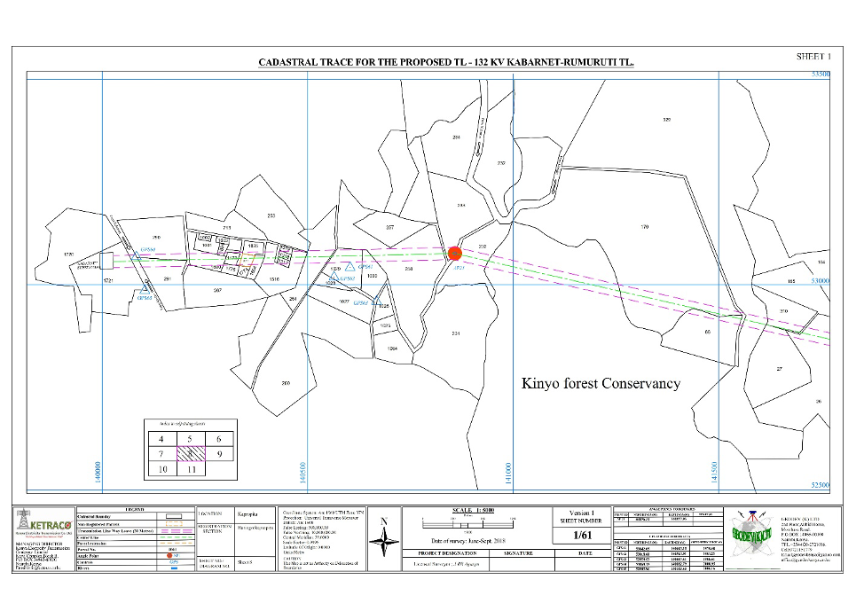
7. SAMPLE OUTPUT/OUTCOME
Some of the acquisition drawings that drawn from the project.
2021
Baringo Laikipia
2024
12 km2,
KETRACO
0712151779
office@geodev.co.ke
View the project
View the project
View the project